| A | The Valley of the Vultures | Version 1 Version 2 |
|
| B | West Shanbar | Version 2 | |
| C | East Shanbar & Witch's Hut | Version 0 Version 2 |
In Version 2, Map G (Hut) was combined into Map C (Shanbar) |
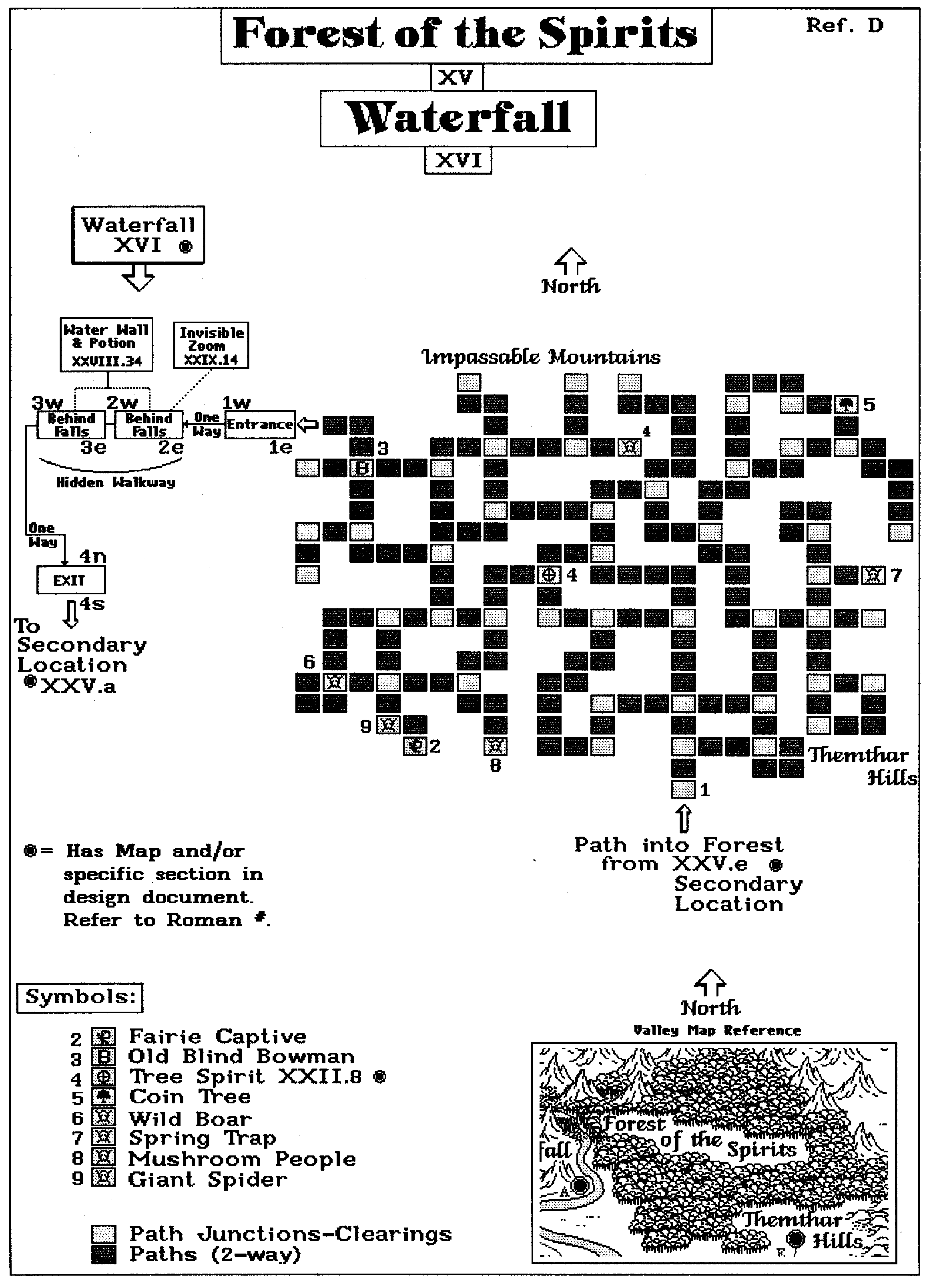
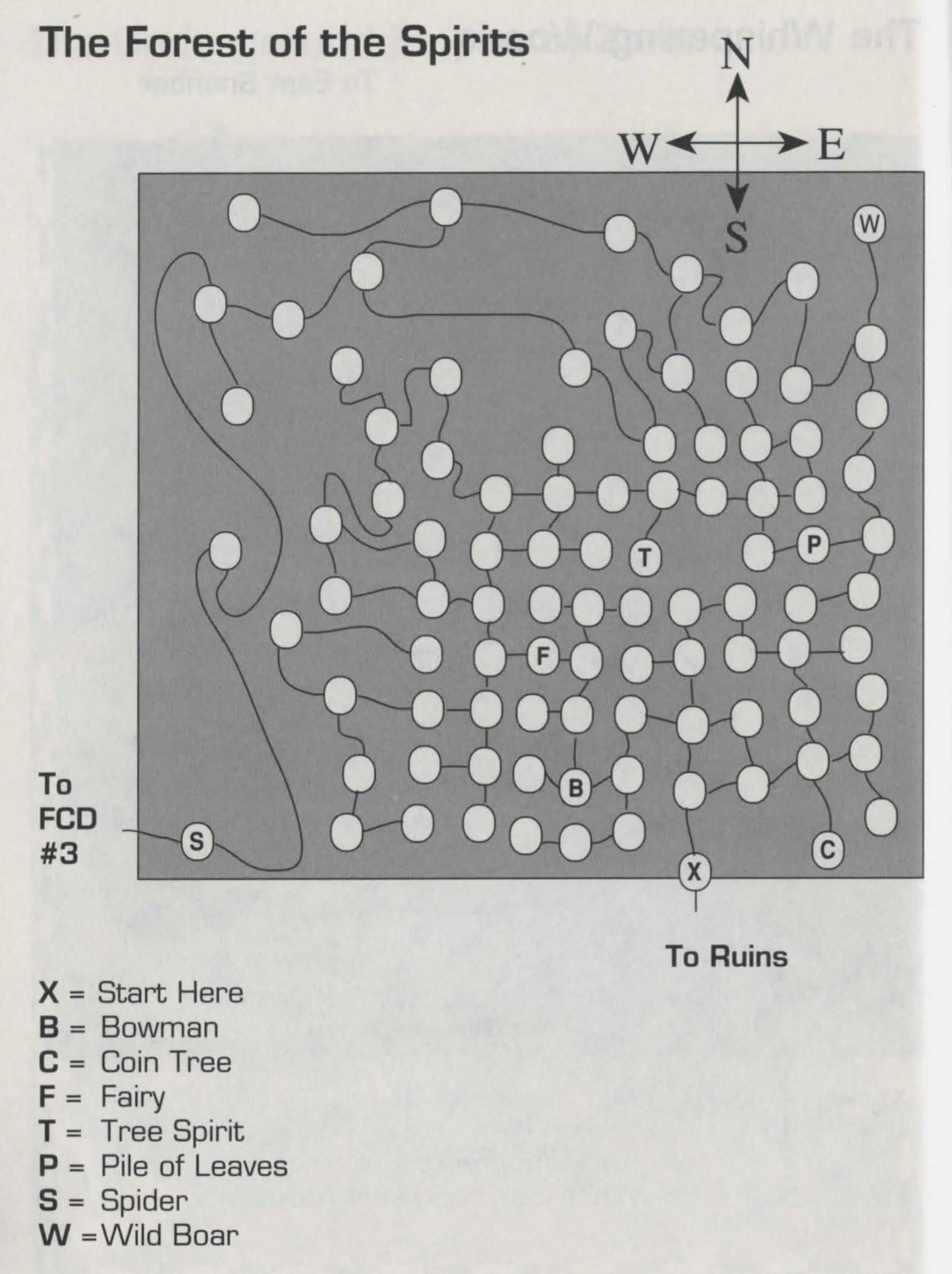
| D | Forest of the Spirits & Waterfall | Version 2 Version 3 |
|
| E | Mountain Pass | Version 2 | |
| F | Snoot's Farm & Pugney Ranch & Vultures Pits | Version 2 | |
| G | [Witch's Hut] | Version 0 Version 1 |
In Version 2, Map G (Hut) was combined into Map C |
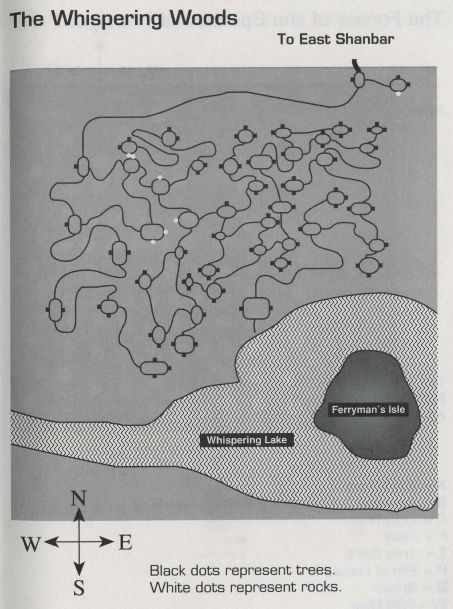
| H | Whispering Woods & Ferryman's Isle | Version 1A Version 2 Version 3 |
|
| I | Bel Naire Temple | Version 0 Version 1 Version 2 |
|
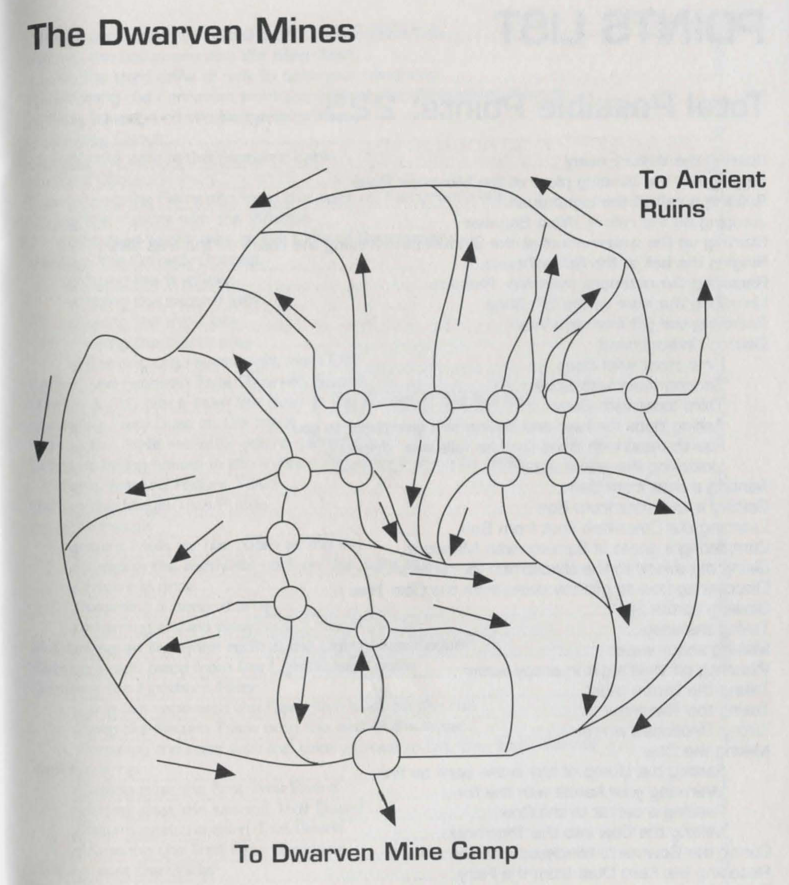
| J | Dwarven Mines & Ancient Ruins | Version 0A Version 1A Version 1B Version 2 Version 3 |
Originally Hidden
Passage instead of Dwarven Mines Originally Hidden Passage instead of Dwarven Mines |
| K | Cliffs of Depression | Version 2 | |
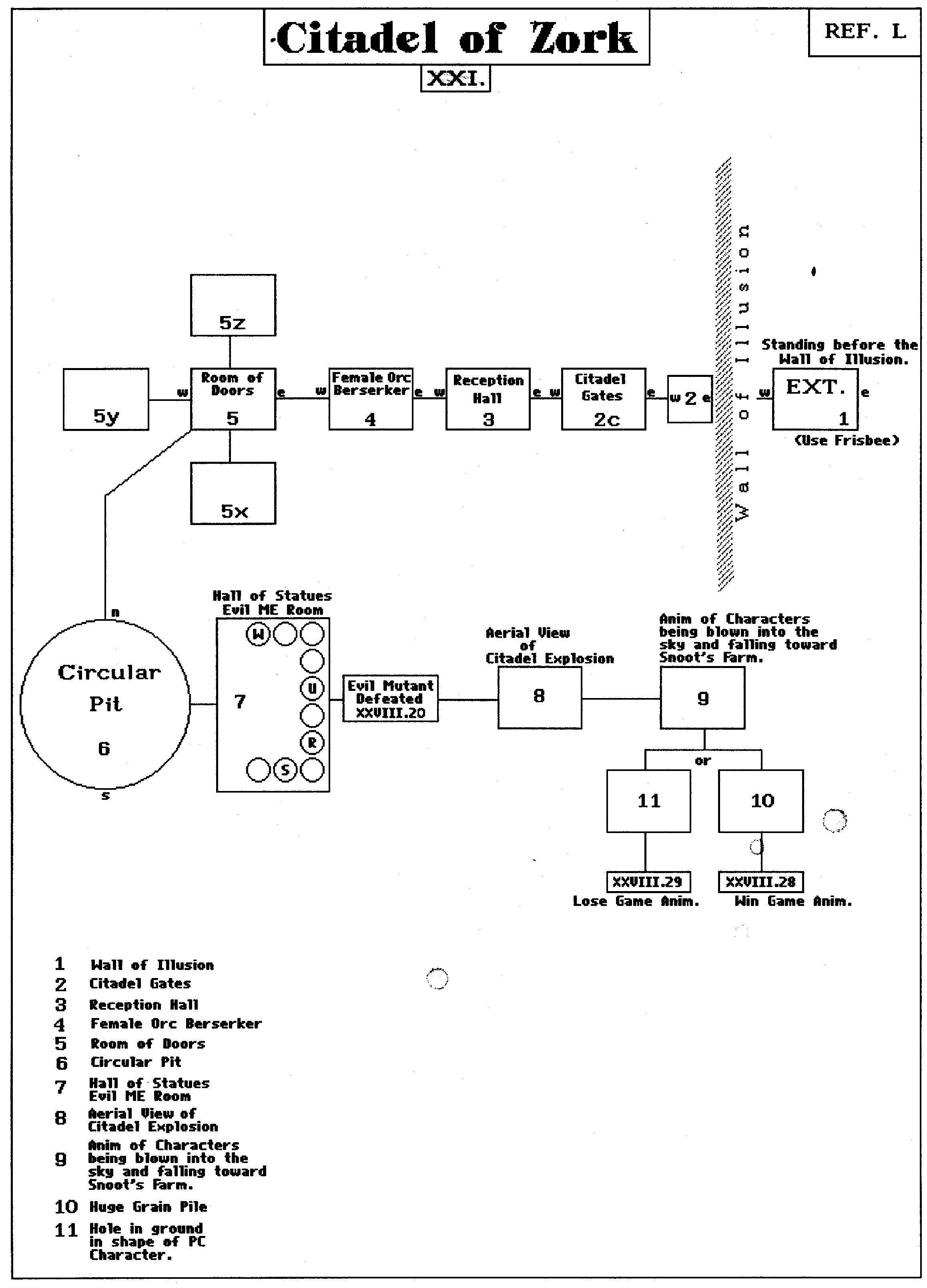
| L | Citadel of Zork | Version 2 | |
| M | Bridge & Old Mill | Version 2 | |
| N | [not available] | Map N was a poor placeholder interface diagram | |
| O | Troll Caverns | Version 2 |